(photo: Taiwan’s MND)
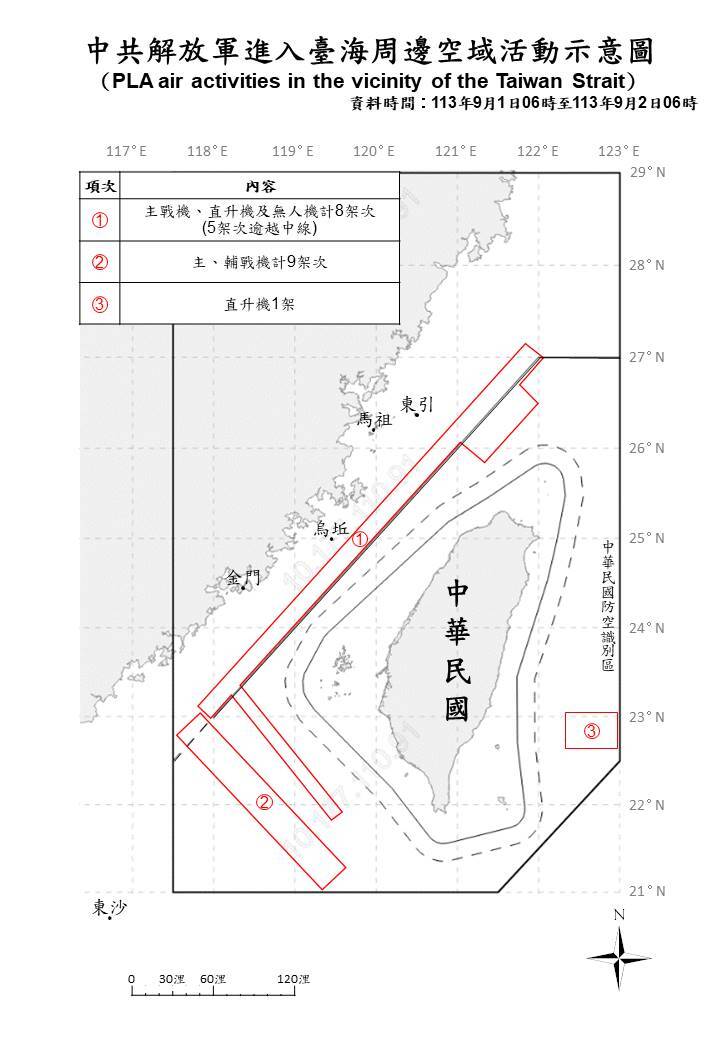
The Taiwanese Ministry of National Defense (MND) announced today (02/09) that from 6 a.m. of 01/09 to 6 a.m. today, 15 CCP‘s fighter aricrafts crossed the center line and intruded into the surrounding airspace. It is worth noting that the Air Force has updated the track map of the common aircraft, in addition to continuing to display the intrusion area, it has also added latitude and longitude and scale to make the chart more accurate.
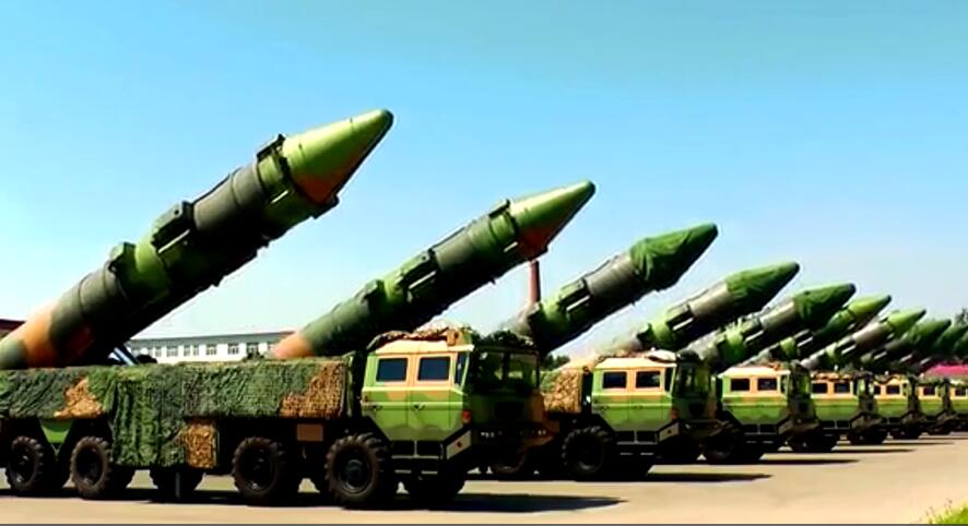
In addition, the MND also announced that the CCP will launch a carrier rocket from the Xichang Satellite Launch Center (西昌衛星發射中心) on the 03/09, which will fly in the direction of the western Pacific Ocean and pass through the Taiwan Air Defense Identification Zone (ADIZ).
According to statistics, from 6 a.m. on 01/09 to 6 a.m. today, 18 fighters were detected (15 of which crossed the center line of the Taiwan Strait to intrude into the northern, southwestern, and eastern airspace), 8 ships, and 2 official ships, continuing to operate around the Taiwan Strait.
The Ministry of National Defense stressed that the Taiwan military uses mission aircraft, ships, and shore-based missile systems to closely monitor and deal with the situation.
The Air Force also updated the track map of the common aircraft, in addition to continuing to show the area and track map of the airspace around Taiwan, the latitude and longitude and scale were also added; However, the distance between the common plane and specific counties, cities and regions in Taiwan is removed, and the old version of the track map is not displayed according to the actual scale of the text.
國防部今天(2日)發布了共機的動態報告,指出自1日上午6時至今天上午6時,共有15架次共機越過中線並擾擾周邊空域。值得一提的是,空軍對共機的航跡圖進行了更新,除了持續顯示擾擾區域外,還新增了經緯度和比例尺,使圖示更加精確。
此外,國防部還透露,中共計劃於3日在西昌衛星發射中心發射運載火箭,該火箭將朝西太平洋方向飛行,並經過台灣的防空識別區(ADIZ)。
國防部上午發布的共機動態報告顯示,自1日上午6時至今天上午6時,偵測到18架次共機(其中15架次越過台灣海峽中線,擾擾北部、西南及東部空域)、8艘共艦及2艘公務船,持續在台海周邊活動。
國防部強調,國軍將利用任務機、艦艇及岸置飛彈系統進行嚴密監控和應對。
此次空軍更新的共機航跡圖,不僅延續顯示共機擾擾台灣周邊空域的區域和航跡,還新增了經緯度和比例尺;同時,取消了共機與台灣特定縣市、區域的距離標示,並刪除了舊版航跡圖中「本圖非按實際比例顯示」的文字。