
by Richard Sanders, Staff Writer
This morning, the Central Weather Administration (CWA) issued land warnings for Typhoon Kong-rey as the storm continued to strengthen on its way toward southern Taiwan.
At 5:30 AM, a land warning was announced for Taitung County and the Hengchun Peninsula, indicating that these areas could experience the storm’s outer effects within 18 hours. By 8:30 AM, Hualien County and all of Pingtung County were also included in the warning.
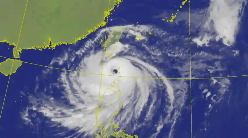
As of 10:15 AM, Typhoon Kong-rey had intensified into a strong typhoon, with maximum sustained winds of 184 kph and gusts reaching 227 kph. At 10 AM, it was located 480 km southeast of Oluanpi, Taiwan’s southernmost point, moving northwest at a speed of 15 to 20 kph.
The CWA expects the entire island to fall under the land warning by late tonight. They project the storm’s outer bands will impact southeastern Taiwan early tomorrow morning, with the storm’s eye likely making landfall south of Hualien County between noon and evening.
Heavy rainfall is anticipated starting today in Keelung, the north coast, and mountainous regions of greater Taipei and Yilan County, raising concerns about flash floods, rockslides, and mudslides. The CWA estimates that mountainous areas in Yilan could receive between 250 mm and 400 mm of rain over the next 24 hours.
In central and southern Taiwan, rainfall is expected to increase only after the storm makes landfall and moves over the Central Mountain Range.
To prepare for the storm, the Taipei City Government announced that vehicles will only be allowed to leave riverside areas starting at 4 PM today, with plans to close floodgates by 10 PM. Taipei Mayor Chiang Wan-an urged residents to secure loose items, as winds could reach levels of 10 on the Beaufort scale (89 kph to 102 kph) in low-lying areas and level 14 (149 kph to 165 kph) in mountainous regions.